
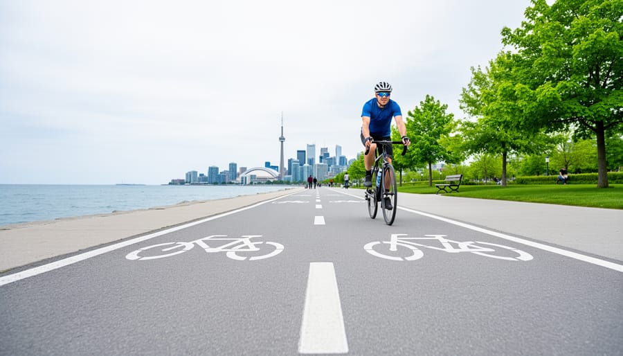
Toronto offers 753 kilometres of dedicated cycling infrastructure spanning on-road bikeways and multi-use trails, giving you one of North America’s most extensive urban cycling networks to explore. Whether you’re planning a quick waterfront ride or a full-day tour through diverse neighbourhoods, the city’s official 2026 cycling map and route planner help you choose paths that match your comfort level and interests.
The beauty of cycling Toronto lies in its variety. You can pedal along Lake Ontario on smooth, separated trails, navigate quiet residential streets through leafy communities, or tackle protected bike lanes that take you straight into the downtown core. Each path type serves different rider preferences, from families with young children to experienced commuters.
What makes Toronto particularly welcoming for cyclists right now is the continued expansion of safe infrastructure. The network has grown significantly, with separated lanes and multi-use trails reducing the need to share busy roads. The city’s official cycling network map lets you filter routes by bikeway type and plan journeys by entering your start location, though it doesn’t currently show construction closures or detours.
Getting started is straightforward. You’ll find Bike Share stations marked on the 2026 map, connecting you to work, school, shopping districts, and recreational areas across the city. The paths take you places worth seeing, from hidden ravines to bustling market districts, giving you a cyclist’s perspective that reveals Toronto’s character in ways driving simply can’t match.
Why Toronto’s Cycle Paths Are Worth Exploring
Toronto offers a cycling experience that stands out among North American cities. With on-road and off-road totals reaching 367km on-road and 386km of multi-use paths, you can pedal from the lakefront to uptown neighborhoods, from historic districts to hidden ravines, all while staying mostly within dedicated cycling infrastructure.
What makes these paths particularly appealing is their variety and purpose. They’re not recreational afterthoughts but genuine transportation corridors connecting homes to offices, schools to shops, and transit hubs to tourist landmarks. A morning commuter route doubles as a weekend family outing path. The waterfront trails give you Lake Ontario views and beach access, while the ravine systems thread through unexpected pockets of forest within city limits. Neighborhood bikeways let you discover cafe strips, cultural venues, and architectural gems at a comfortable pace.
Safety shaped much of this network’s design. Toronto has invested heavily in separated bikeways with physical barriers between cyclists and traffic. Research shows protected lanes reduce deaths and injuries, making these routes accessible to children, seniors, and anyone new to urban cycling. Many paths are completely off-road, winding through parks where the only traffic is pedestrians and fellow cyclists.
The local cycling community adds another layer of value. Passionate riders who know which route offers the best skyline view or where to find that perfect coffee stop midway through your ride share their expertise through guided tours. Their first-hand knowledge transforms a simple path into a curated experience, revealing stories and shortcuts no map can capture.
Top Cycle Path Routes and Areas in Toronto
1. Waterfront Trail (Martin Goodman Trail)
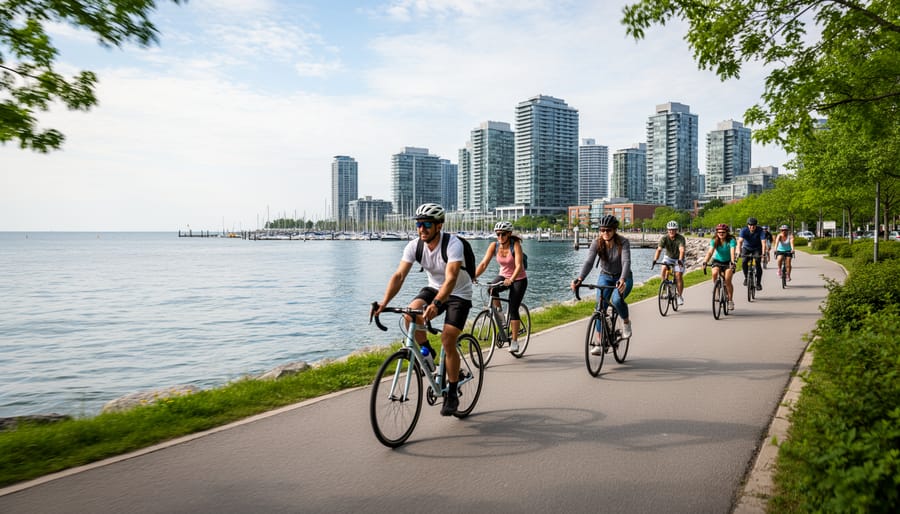
The Martin Goodman Trail stretches for approximately 22 kilometres along Toronto’s waterfront, offering uninterrupted views of Lake Ontario and the city skyline. This paved, multi-use path runs from the Humber River in the west through the heart of downtown to the Beaches neighbourhood in the east, connecting some of Toronto’s most popular attractions along the way.
You’ll pass through harbourfront districts alive with sailboats and ferries, pedal beside sandy beaches perfect for summer picnics, and glide through waterfront parks where families gather for festivals and outdoor concerts. The trail connects directly to attractions like the Harbourfront Centre, the Music Garden, and Sugar Beach, giving you easy access to Toronto’s vibrant lakefront culture. Because it’s completely separated from vehicle traffic, the path welcomes families with young children, casual riders, and anyone seeking a relaxed cycling experience without navigating busy streets.
The terrain stays reliably flat throughout, making it accessible for riders of all ages and fitness levels. You can tackle the entire length in a few hours or focus on shorter segments that interest you most. The trail also connects seamlessly with downtown and island routes letting you extend your exploration to the Toronto Islands via the ferry or venture into urban neighbourhoods. Wide sightlines and regular access points make it easy to take breaks, snap photos, or stop for refreshments at the many cafes and restaurants along the shore.
2. Don Valley Trail System
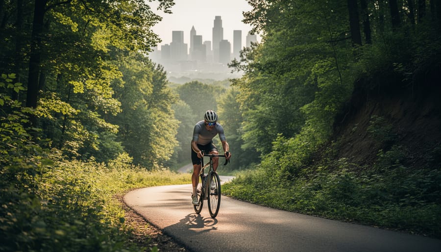
The Don Valley Trail System offers a remarkable escape into nature without leaving the city. This network of off-road paths winds through Toronto’s extensive ravine system, following the Don River and its tributaries as they cut through the urban landscape. Dense tree canopy, naturalized creek banks, and quiet forested sections create a surprisingly peaceful atmosphere just minutes from busy downtown streets.
Riders often spot wildlife along these trails, herons fishing in shallow pools, turtles sunning on logs, and deer browsing in the undergrowth during quieter morning hours. The paths connect multiple neighborhoods from the north end of the city down to the waterfront, passing through parks like Sunnybrook, Edwards Gardens, and Crothers Woods. Each section offers its own character, from manicured garden paths to wilder ravine corridors.
The terrain here is more varied than the flat waterfront routes, with gentle climbs and descents that follow the natural topography. These grades are manageable for most cyclists but add a bit of challenge and visual interest as you move through different elevations. The trails suit anyone comfortable with moderate riding who wants green space and a break from traffic noise. Some sections get muddy after rain, so plan accordingly and enjoy the feeling of pedaling through Toronto’s hidden natural corridors.
3. Bloor Street Bikeway

The Bloor Street Bikeway stretches nearly 7 kilometres across Toronto’s core, linking the neighbourhoods of Roncesvalles in the west to Castle Frank in the east. Protected barriers separate cyclists from car traffic along most of the route, making it one of the city’s safest and most heavily used bikeways. You’ll ride through constantly shifting streetscapes, Victorian houses give way to Art Deco towers, then to contemporary glass condos, all while staying on one continuous path.
This bikeway puts you in the middle of Toronto’s urban life. In the Annex you’ll pass cafes packed with students and browsing crowds outside bookshops. Through Yorkville the architecture tilts upscale, with boutiques and galleries lining side streets. The Korean neighbourhood around Christie brings restaurant signs in Hangul and the smell of barbecue. Each stretch feels distinct, yet the protected lane keeps the riding smooth and predictable.
Transit access is exceptional here. Bloor-Danforth subway stations sit every few blocks, and the bikeway runs directly above the subway line for much of its length. You can easily combine cycling with TTC connections to reach starting points or extend your exploration. The route also intersects with north-south bikeways, letting you branch off toward the waterfront or into residential areas without losing protected infrastructure.
4. West Toronto Railpath
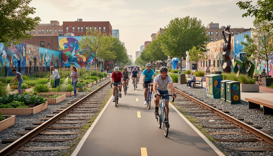
The West Toronto Railpath transforms a former railway corridor into a vibrant 2.1-kilometre cycling and pedestrian route connecting Junction Triangle, Wallace-Emerson, and neighbourhoods near Dupont and Lansdowne. This completely car-free off-road path has become one of the city’s busiest cycling commuter routes, offering a peaceful alternative to congested streets while moving smoothly through some of Toronto’s most creative and evolving west-end communities.
What sets the Railpath apart is its role as both transportation corridor and public art gallery. Colourful murals, sculptures, and installations line the route, many created by local artists through community initiatives. You’ll pass urban gardens where residents grow vegetables and flowers, and benches invite you to pause and watch the neighbourhood life unfold around you. The path runs below street level in many sections, creating a quiet green corridor that feels removed from city traffic despite being steps from bustling commercial streets.
The Railpath connects directly to trendy areas like the Junction, packed with independent coffee shops, craft breweries, and vintage stores worth exploring before or after your ride. It also links to GO Transit’s Bloor station and multiple TTC stops, making it easy to combine with public transit. For commuters, the route provides a quick, flat connection between west-end homes and downtown workplaces. For visitors, it offers an authentic glimpse into Toronto’s creative communities and how cycling infrastructure weaves into daily urban life.
5. Humber River Trail
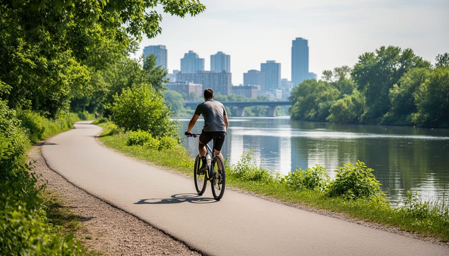
The Humber River Trail offers an escape into nature without leaving Toronto’s boundaries. This extensive trail system winds alongside the Humber River through forested ravines, wetlands, and parkland, creating a peaceful corridor that feels remarkably remote despite being surrounded by the city. The varied terrain includes gentle riverside stretches, challenging hills, and winding paths through mature woodlands where you might spot herons, turtles, or deer.
Starting from Lake Ontario at the Waterfront Trail, the Humber system extends north through multiple parks including Etienne Brulé Park, King’s Mill Park, and beyond into the Humber Valley. The southern portions offer easier riding with paved surfaces and moderate grades, while northern sections become more rugged with natural surfaces and steeper climbs. This makes the Humber ideal for cyclists ready to tackle longer distances and varied conditions, with round trips easily extending to 30 kilometres or more if you explore the full network.
The trail connects numerous access points and parking areas, letting you start from various neighborhoods. Pack snacks and water since facilities are limited once you’re deep in the ravine. Early morning and weekday rides provide the most solitude and best wildlife viewing opportunities.
6. Historic Distillery District and Port Lands Routes
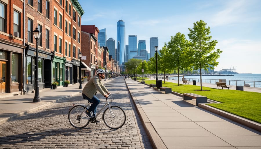
The Historic Distillery District offers one of Toronto’s most photogenic cycling experiences, where Victorian-era industrial architecture meets contemporary art and culture. This pedestrian-oriented area features cobblestone streets and brick buildings that once housed the Gooderham and Worts Distillery, now transformed into galleries, studios, boutiques, and cafes. Cycling here means dismounting and walking your bike through the main pedestrian areas, but the surrounding streets and connections make it an ideal stop on a waterfront route. The area provides exceptional photo opportunities with its preserved 19th-century facades, public art installations, and the contrast between historic structures and modern urban life.
East of the Distillery, the Port Lands represent Toronto’s most dramatic transformation. This former industrial waterfront is being reimagined with new parks, naturalized river mouth areas, and cycling connections that reveal the city’s evolving relationship with Lake Ontario. Rides through this emerging district showcase raw industrial heritage alongside brand-new green spaces and reveal how Toronto is reclaiming its waterfront. The flat terrain and wide paths make navigation straightforward, while the mix of heritage and renewal appeals to history enthusiasts and urban explorers alike. Spring through fall offers the best conditions for appreciating both the architectural details and the waterfront setting.
7. Midtown and Uptown Neighborhood Bikeways
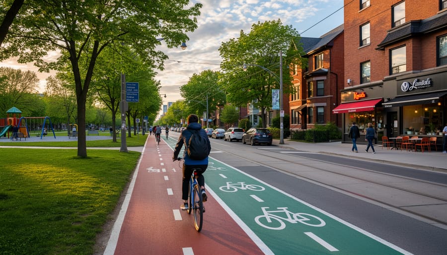
Midtown and uptown neighborhoods offer a calmer side of Toronto cycling, with residential street bikeways designed to feel more like extensions of the community than transportation corridors. Areas like Yonge-Eglinton, Mount Pleasant, and sections of North York feature painted bike lanes and shared streets that weave through tree-lined blocks, connecting local amenities without the intensity of downtown traffic. These routes excel at what Toronto cyclists call “everyday riding”, the kind where you can chat with a fellow rider, notice a garden in bloom, or easily pull over when a child needs a water break.
The appeal here is discovery at a neighborhood pace. You’ll pass branch libraries where families stop to browse, small parks with playgrounds perfect for a mid-ride stretch, and independent cafes that welcome cyclists leaning bikes against storefronts. Recreation centres dot these areas, making natural rest points with washrooms, water fountains, and sometimes splash pads in summer. The routes often parallel or intersect major streets but stick to quieter alternatives, a parallel residential road instead of the main artery.
For families, these bikeways reduce the anxiety of riding with children. Traffic moves slowly, crossings are manageable, and there’s always somewhere welcoming to pause. Guided tours in these areas highlight spots you’d miss on your own: the best gelato stop after a library visit, a hidden courtyard garden, or which recreation centre has the friendliest staff. It’s Toronto cycling at its most accessible and human-scaled.
Planning Your Cycle Path Route: Maps and Tools
The City of Toronto cycling network map is your primary planning tool, offering a comprehensive view of all 367km of on-road bikeways and 386km of multi-use off-road paths throughout the city. Start by entering your address or desired start location in the search bar to generate a route tailored to your starting point. The map’s most useful feature is its ability to filter by bikeway type using the Filter Results dropdown menu, letting you choose between on-road lanes, separated bikeways, and off-road trails based on your comfort level and preferences.
For a broader overview, the 2026 Toronto Cycling Map displays not just bikeways but also Bike Share station locations, suggested routes, and connections to everyday destinations like work, schools, shopping districts, and tourist sites. Paper copies of this 2026 map will be available this spring at convenient pickup locations across the city:
- Toronto Public Library branches throughout all neighborhoods
- Community and recreation centres citywide
- City Hall 311 Information Desk in the downtown core
- Local bike shops across Toronto
Keep in mind that the cycling network map doesn’t show temporary closures or construction detours, so it’s smart to check current conditions before heading out, especially for longer routes or unfamiliar areas.
While maps provide the infrastructure layout, they can’t show you the hidden viewpoints, quietest times to ride, or the stories behind different neighborhoods. That’s where guided tours in Toronto add real value. Local guides combine route planning with insider knowledge, navigating around closures, suggesting the best stopping points, and revealing architectural gems or natural features you’d likely miss on your own. They know which path combinations create the most rewarding loops and can adapt routes on the fly based on weather, group interests, or unexpected discoveries along the way.
Practical Information for Cycling Toronto’s Paths
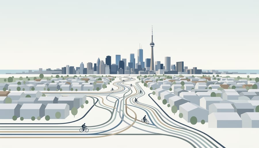
Getting ready for a Toronto cycling adventure takes a bit of planning, but the city’s infrastructure and local tour operators make it straightforward for everyone from solo explorers to large groups.
Bike Rental and Equipment
You don’t need your own bike to explore Toronto’s paths. Rental options include standard adult bikes, bikes with child seats, and tandems for couples who want to ride together. Most rental operations provide helmets and basic safety equipment as part of the package. When you pick up your bike, expect a quick safety check and adjustment to ensure proper fit, comfortable saddle height and handlebar position make a huge difference on longer rides. Lock and bell typically come with the rental, and some operators include panniers or baskets for carrying water and snacks.
Guided Tours vs. Independent Exploration
Guided tours offer the advantage of local knowledge, experienced guides who are First Aid/CPR certified can navigate the network efficiently, point out hidden gems, and handle any issues that arise. They’re particularly valuable for visitors unfamiliar with the city or groups wanting a curated experience without the navigation stress. Independent riders can use the official City maps and create their own adventure, though you won’t benefit from the insider commentary and route optimization that guides provide.
Seasonal Timing and Route Duration
Toronto’s cycling season runs roughly April through October, with May through September offering the most reliable weather. Spring brings blooming parks but occasional rain, summer means busy paths and hot afternoons (early morning rides beat the crowds), and fall delivers spectacular foliage along ravine trails. A waterfront ride might take two hours at a leisurely pace, while exploring multiple neighborhoods or the Don Valley system could fill four to five hours with stops.
Do I need to bring my own bike?
No, rental bikes are widely available with various options including standard bikes, child seats, and tandems.
Are helmets provided?
Yes, helmets and basic safety equipment are typically included with bike rentals.
How long do typical routes take?
A waterfront ride takes about two hours leisurely, while longer neighborhood or ravine explorations can take four to five hours with stops.
Are the paths suitable for children?
Yes, many routes like the Waterfront Trail and neighborhood bikeways are family-friendly with flat terrain and separated paths.
Can I join a guided tour or explore independently?
Both options work, guided tours provide local expertise and First Aid/CPR certified guides, while independent exploration lets you set your own pace using official City maps.
Accessibility for All Skill Levels
The network accommodates everyone from cautious beginners to confident urban cyclists. Flat waterfront paths and residential bikeways suit family bicycle trips with young children, while hillier ravine trails challenge more experienced riders. Separated bikeways provide protected space away from car traffic, making them ideal for those building confidence. Tour operators can tailor routes to match your group’s fitness level and interests, whether that’s architectural sightseeing stops every few blocks or longer stretches between destinations.
Corporate groups often book private tours that combine team-building with Toronto exploration, accommodating anywhere from small teams to larger department outings. Family packages ensure even the youngest riders (in child seats or on their own bikes) can participate safely with appropriate route selection and pacing.
Local Tips for the Best Cycle Path Experience
Early weekday mornings (before 9am) and late afternoons on weekdays offer the quietest rides, especially on popular routes like the Waterfront Trail. Weekends bring more families and leisurely riders, so plan for a slower pace and more stops if you’re on multi-use paths during peak hours.
The real magic happens when you combine different path types in a single ride. Start on a separated bikeway like Bloor Street to reach a neighborhood, then duck into the ravine system for a natural break before emerging near the waterfront. These custom loops let you experience Toronto’s architectural diversity, green corridors, and lakefront views without backtracking. Local guides know which combo tour connections work best for your interests and fitness level.
Spring brings cherry blossoms along the Don Valley Trail, while fall colours transform the Humber River route into a photographer’s dream. Summer means extended daylight for evening rides, and winter offers surprisingly rideable conditions on cleared main bikeways when you dress in layers.
Stop at Balzac’s Coffee in the Distillery District for a mid-ride espresso, or pack snacks for a break at Riverdale Park East with skyline views. The junction where the West Toronto Railpath meets the Waterfront Trail offers several cafe options and easy route extensions in any direction.
Experienced cyclists watch for car doors on street bikeways, anticipate pedestrian movements near transit stops, and make eye contact with drivers before crossing intersections. Signal your turns clearly, especially when riding with a group. These habits matter more than route knowledge, and riding with guides who demonstrate them builds confidence for your own explorations.
Toronto’s cycle paths offer one of the most rewarding ways to experience the city, connecting you directly to neighborhoods, green spaces, and waterfront beauty that many visitors miss. With over 750 kilometers of on-road and off-road routes, the network accommodates everyone from families seeking leisurely lakefront rides to urban explorers tracing historic districts and cultural hotspots. The separated bikeways and multi-use trails provide safe, accessible infrastructure that lets you focus on discovery rather than navigation stress.
Whether you’re planning your own route using the City of Toronto’s cycling network map or joining a guided tour with local experts who know the hidden viewpoints and best stopping points, you’ll find that two wheels reveal a different Toronto. The First Aid and CPR certified guides bring stories and insider knowledge that transform a simple ride into genuine connection with the city’s character.
Grab a bike, pick a path that matches your mood, and let Toronto’s dynamic spirit unfold around you, one pedal stroke at a time.